
Getting Around Rancho Penasquitos, CA: A 2026 Commuter's Guide
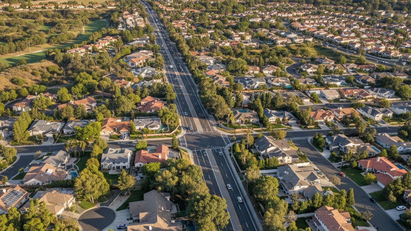
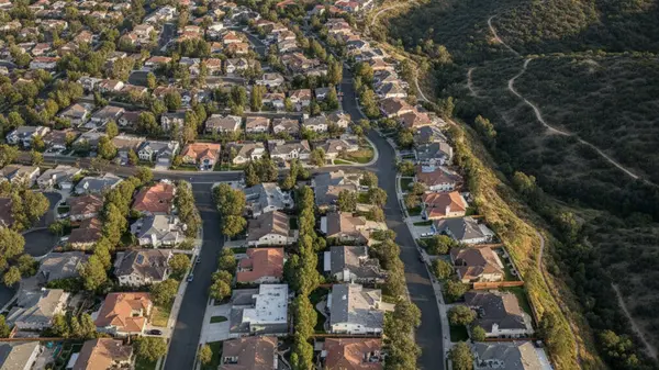
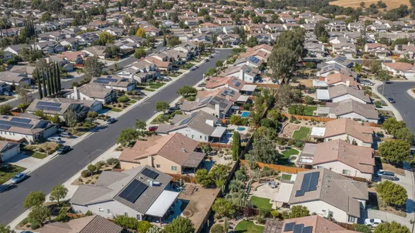
Getting around Rancho Penasquitos, CA involves a mix of local arterials and state routes to reach the coast or downtown. The community spans about 6,500 acres of varied terrain within San Diego County, CA. Residents rely on two major regional highways bordering the neighborhood for longer trips.
Daily travel in this suburb centers around the intersection of Interstate 15 and California State Route 56. Understanding the local traffic patterns and transit stations can shape where buyers choose to look for homes. A house near the eastern edge offers a different morning routine than a property closer to the western boundary.
Highway Access and Major Local Roads
Interstate 15 runs directly along the eastern edge of Rancho Peñasquitos, CA, providing a straight path into central San Diego. California State Route 56 cuts horizontally through the southern portion of the neighborhood. This east-west highway links I-15 to Interstate 5 near the coast.
Drivers moving within the community use a handful of primary local roads to reach these highways. Black Mountain Road serves as a main north-south artery running through the center of the area. Carmel Mountain Road handles much of the traffic moving toward the northeastern residential zones.
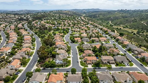
Traffic flow on these local roads peaks during the morning and afternoon school runs. Buyers looking at properties along these main corridors should factor in lower speed limits and school zone traffic lights. Many of the residential subdivisions branch off into cul-de-sacs, keeping through-traffic limited to the primary roads.
Drive Times to Major Employment Centers
The drive from Rancho Peñasquitos, CA to the Sorrento Valley tech hub covers roughly seven to ten miles. Morning commuters taking westbound SR-56 usually spend 15 to 25 minutes on the road. Afternoon return trips often take slightly longer due to eastward bottlenecks near the I-15 interchange.
Commuters heading to Downtown San Diego travel about 22 miles south via I-15. This trip typically takes 25 to 35 minutes outside of peak hours. During the morning rush, drivers should expect delays near the Mira Mesa and Tierrasanta exits.
Shorter trips to nearby commercial hubs require minimal highway driving. Reaching the corporate parks in Carmel Mountain Ranch or Rancho Bernardo takes under 15 minutes via local roads.
Public Transit Options and Express Buses
The Sabre Springs/Peñasquitos Transit Station sits just east of the neighborhood along the I-15 corridor. This facility serves as the primary public transit hub for local residents heading into the city. Commuters can leave their cars in the dedicated Park and Ride lot before boarding.
San Diego MTS operates several Rapid bus routes from this station. Rapid 235 and Rapid 290 offer express service directly to Downtown San Diego with limited stops. These high-frequency buses use the dedicated transit lanes on I-15 to bypass standard highway traffic.
Local bus routes also connect the interior of the Peñasquitos community to the transit station. Route 20 loops through the main thoroughfares, providing an alternative to driving to the Park and Ride. Buyers prioritizing public transit should check the walking distance from prospective homes to these local bus stops.
Paved Bike Paths and Trail Connections
The SR-56 Bike Path provides 10.5 miles of paved, separated riding surface parallel to the highway. Cyclists use this route to travel east-west across present-day San Diego County without sharing lanes with vehicle traffic. The path connects directly to the coastal bike networks near Interstate 5.
A recent trail extension under the I-5 interchange added 860 feet of dedicated pathway. This underpass links the SR-56 path to the Sorrento Valley transit station and nearby office parks. Commuters can now ride all the way to the coast while avoiding major road crossings.
Unpaved options exist for recreational riding and hiking. Los Peñasquitos Canyon Preserve offers miles of dirt trails along the southern border of the community. Black Mountain Open Space Park provides steeper, varied terrain for mountain bikers and hikers on the northern edge.
Reaching Daily Amenities and Schools
Only about two percent of the land in Rancho Peñasquitos, CA is zoned for commercial use. The Rancho Peñasquitos Towne Center serves as the primary retail hub on the western side of the community, meaning most residents drive or bike to buy groceries.
Students in the area attend campuses within the Poway Unified School District. Most residential subdivisions sit within a short drive or bike ride of a local elementary or middle school. Mount Carmel High School and Westview High School serve as the two main secondary campuses for the neighborhood.
Buyers should map the distance from specific neighborhoods to the Towne Center or nearby grocery stores. Homes in the northeastern section sit closer to the Carmel Mountain Plaza in the neighboring community. Properties on the western edge offer faster access to the retail options along Carmel Valley Road.
Trips to San Diego International Airport
San Diego International Airport sits roughly 22 to 25 miles south of the neighborhood. The most direct route follows I-15 South to State Route 163, which drops drivers straight into the downtown area near the terminals. This drive takes 30 to 45 minutes in standard traffic conditions.
Early morning or late evening flights often allow for a 25-minute drive. Midday or rush-hour departures require extra buffer time for congestion at the I-15 and SR-163 merge. Travelers should check live traffic updates before leaving the house.
Rideshare services like Uber and Lyft operate continuously throughout the community. Local residents frequently use these apps or private airport shuttles as a hands-off alternative to long-term parking.
Frequently Asked Questions
How far is Rancho Peñasquitos from the ocean?
The neighborhood sits about nine miles inland from the Pacific coast. Reaching the sand at Torrey Pines State Beach takes roughly 15 minutes by car via State Route 56. Cyclists riding the local paved trails can expect a 45-minute pedal to reach the coastal highway.
What are the public transit options from Rancho Peñasquitos to Downtown San Diego?
The Sabre Springs transit hub offers the fastest public route via the MTS Rapid network. A one-way trip on Rapid 235 takes about 45 minutes to reach the Broadway stations downtown. Riders pay standard MTS fares, making this a cost-effective alternative to daily downtown parking fees.
How long does it take to get from San Diego Airport to Rancho Peñasquitos?
While the outbound trip takes about 35 minutes, the return journey from the airport terminal can take closer to 50 minutes during the late afternoon. Northbound traffic often slows where SR-163 merges onto I-15. Travelers landing during peak commute hours should consider scheduling an Uber in advance to avoid long waits at the pickup curb.
Categories
Recent Posts


GET MORE INFORMATION